The New International Atlas

The New International Atlas

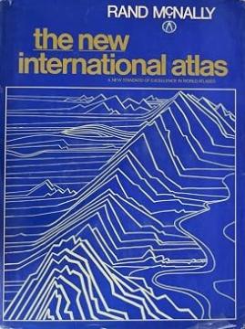
The monumental cartographic work The New International Atlas by Rand McNally from 1980 provides extremely precise multilingual maps and a detailed overview of the geopolitical landscape of the world during the Cold War.

The jubilee and expanded edition of The New International Atlas from 1980, published by the famous cartographic company Rand McNally, is considered one of the most respected and accurate world atlases of the 20th century. Created in collaboration with top international cartographic experts, this atlas stands out for its unique multilingual approach – all key terms, legends and indexes are printed in English, French, German, Spanish and Portuguese.

The atlas is recognizable by its large format, superb graphics and standardized map scale that allows for easier comparison of different regions of the world. Special attention is paid to detailed depictions of densely populated urban areas, relief maps and thematic depictions of natural resources, climate and population.

The 1980 edition is an exceptionally valuable historical and geopolitical document that faithfully depicts the world at the height of the Cold War. His maps clearly depict countries and borders that no longer exist, such as the Soviet Union, Czechoslovakia, Yugoslavia, and divided Germany. Due to its aesthetic value, professional meticulousness, and historical significance, this atlas is highly sought after by collectors and cartographic enthusiasts.

Dimensions
38 x 28 cm
Pages
552
Publisher
Rand McNally, London, 1980.
 
Latin alphabet. Hardcover with dust jacket.
Language: English.

One copy is available

Condition:Used, very good condition
Damages or inconvenience notice:
  • The cover is missing
 

Are you interested in another book? You can search the offer using our search engine or browse books by category.

You may also be interested in these titles

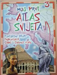
Moj prvi atlas svijeta 3: Povijesni atlas - prapovijest, stari i srednji vijek

Moj prvi atlas svijeta 3: Povijesni atlas - prapovijest, stari i srednji vijek

Edukativni dečji atlas iz 2013. Kroz šarene mape i ilustracije vodi najmlađe na putovanje kroz praistoriju, antičko i srednjovekovno doba, otkrivajući ključne događaje i drevne civilizacije.

EPH media d. o. o., 2013.
Croatian. Latin alphabet. Paperback.
2.50 €
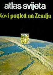
Atlas svijeta – Novi pogled na Zemlju

Atlas svijeta – Novi pogled na Zemlju

Atlas literatura na našem jeziku „Atlas sveta – novi pogled na zemlju“ je prvi moderno koncipiran atlas.

Sveučilišna naklada Liber (SNL), 1978.
Croatian. Latin alphabet. Hardcover with dust jacket.
6.82 €
Politički atlas

Politički atlas

Politički atlas (Učila, Zagreb, 1957) je džepni atlas sa političkim kartama sveta i pregledom zemalja, granica i geografskih karakteristika u periodu posle Drugog svetskog rata.

Učila - Kartografija, 1957.
Croatian. Latin alphabet. Hardcover.
6.42 €
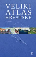
Veliki atlas Hrvatske

Veliki atlas Hrvatske

Veliki atlas Hrvatske pruža pregled prirodnih, istorijskih, ekonomskih i društvenih karakteristika Hrvatske kroz detaljne karte, fotografije i pregledne tekstove. Prvi hrvatski topografski atlas u razmeri 1:100.000.

Mozaik knjiga, 2012.
Croatian. Latin alphabet. Hardcover.
24.32 €
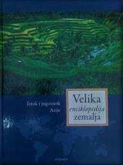
Velika enciklopedija zemalja 9: Istok i jugoistok Azije

Velika enciklopedija zemalja 9: Istok i jugoistok Azije

24 sata, 2009.
Croatian. Latin alphabet. Hardcover.
5.94 - 5.98 €
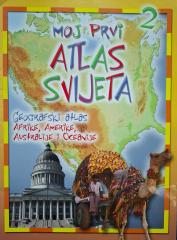
Moj prvi atlas svijeta 2: Geografski atlas Afrike, Amerike, Australije i Oceanije

Moj prvi atlas svijeta 2: Geografski atlas Afrike, Amerike, Australije i Oceanije

Edukativni dečji atlas iz 2013. Kroz šarene mape i ilustracije vodi najmlađe na putovanje kroz Afriku, Ameriku, Australiju i Okeaniju, otkrivajući njihovu prirodnu i kulturnu raznolikost.

EPH media d. o. o., 2013.
Croatian. Latin alphabet. Paperback.
2.50 €